Addressing Climate Change and Connectivity Challenges
Upper Nile needs infrastructure designed for water, distance and a changing climate—not projects that fail with the first severe flood.
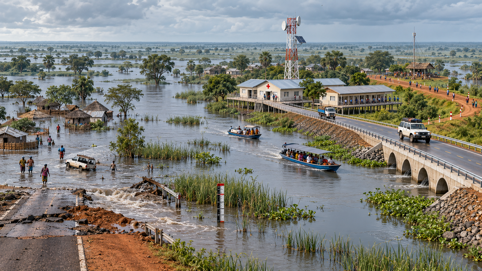
Illustrative resilience concept—not a geographic map—showing raised services, river transport, communications and an all-weather route.
Upper Nile’s climate and connectivity problems reinforce one another. Flooding damages roads, isolates villages, closes schools, contaminates water sources and prevents farmers from reaching markets. Weak communications then make it harder to warn communities, coordinate rescue operations, monitor disease or document emerging conflict.
Climate policy and connectivity policy must therefore be designed together.
Flooding is no longer an exceptional event
A national flood assessment published by UNDP in 2023 found that more than two million people across South Sudan had been affected, with major consequences for development, humanitarian response and peacebuilding. UNICEF identifies Upper Nile, Jonglei and Unity as the hardest-hit states, accounting for about three-quarters of people affected in recent severe flooding.
New research published in August 2026 traced the movement of water from Lake Victoria into the Sudd and found that the flood wave can take approximately 17 months to pass through the connected system—far longer than an earlier assumption of about five months. Lakes and wetlands may store and release water over several years.
This means authorities cannot base planning solely on local rain during a single season. Flood preparedness must use regional hydrological information and multi-year forecasts.
A network suited to the terrain
Traditional road construction alone will not end isolation. Priority roads should be raised, adequately drained and maintained, but waterways must also be recognised as essential transport corridors.
A resilient network should combine all-weather road sections, raised feeder routes, culverts, river ports, inspected passenger boats, solar-powered telecommunications towers, satellite links for isolated clinics and schools, community radio and elevated warehouses.
Digital access as public infrastructure
Mobile and internet connectivity can deliver flood alerts, market prices, mobile money, remote learning, telemedicine, civic education and humanitarian coordination. Yet rural deployment may remain commercially unattractive without public support.
Government should promote infrastructure sharing among operators and establish transparent subsidies for schools, clinics, border centres and county headquarters. Solar community Wi-Fi can complement mobile networks, while radio remains essential for residents without smartphones or affordable data.
Adaptation without forced displacement
Upper Nile needs a permanent climate-resilience programme mapping flood-exposed settlements, roads, health facilities, schools and communications towers. Food, medicine, fuel and learning supplies should be positioned before access routes close. Water points and public buildings should be elevated where possible, while farmers receive access to flood-tolerant crops and livelihood diversification.
Relocation should remain a last resort. Communities must participate in decisions about embankments, settlement movement, land allocation and compensation. Adaptation cannot become a justification for dispossessing people from valuable land.
Sources and further reading
- UNDP, 26 April 2023: national flood assessment.
- UNICEF South Sudan: climate change, affected services and flood preparedness.
- Hydrology and Earth System Sciences, 20 August 2026: flood-wave timing and wetland buffering from Lake Victoria to the Sudd.